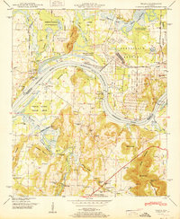
1951 Map of Triana
USGS Topo · Published 1951About this map
The Tennessee River-Wheeler Reservoir dominates this 1940s landscape, serving as the border between Madison and Morgan counties. The northern bank is largely defined by the expansive Wheeler National Wildlife Refuge and the developing military footprints of the Huntsville Arsenal and Redstone Arsenal. South of the river, the terrain rises sharply toward Brindley Mountain, where a rural network of churches and cemeteries reveals a long-established agrarian community. Local landmarks such as Mt Moriah Church, Mt Pleasant Church, and Leadus Sch serve as focal points for settlements like Talucah and Valhermoso Springs. The presence of numerous family burial grounds, including the Draper Cem and Ballinger Cem, provides significant genealogical value for those tracing lineage in this river valley region.
Find a feature on this map
50 named features on this map. Tap any name to fly to it.
Don’t see what you’re looking for? This feature index may not catch every label — zoom into the map to look around manually.
Map Details
Editions of this 1951 Triana Map
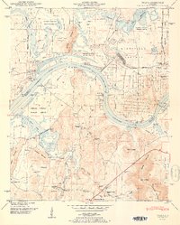
2 editions found
Other maps of this area

1888 · Cullman
USGS Topo · 1:125,000

1888 · Huntsville
USGS Topo · 1:125,000

1892 · Cullman
USGS Topo · 1:125,000

1892 · Huntsville
USGS Topo · 1:125,000

1936 · Triana
USGS Topo · 1:24,000

1936 · Madison
USGS Topo · 1:24,000

1936 · Somerville
USGS Topo · 1:24,000

1936 · Center Grove
USGS Topo · 1:24,000

1936 · Mason Ridge
USGS Topo · 1:24,000

1936 · Greenbrier
USGS Topo · 1:24,000