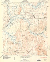
1951 Map of Triana
USGS Topo · Published 1951About this map
Triana sits at the bend of the Tennessee River-Wheeler Reservoir, marking a landscape where post-war military expansion and wildlife conservation meet. To the north and east, the restricted grounds of the Huntsville Arsenal and Redstone Arsenal occupy significant acreage, while the Wheeler National Wildlife Refuge preserves the bottomlands along the river and Indian Creek.
Find a feature on this map
53 named features on this map. Tap any name to fly to it.
Don’t see what you’re looking for? This feature index may not catch every label — zoom into the map to look around manually.
Map Details
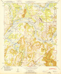
Editions of this 1951 Triana Map
2 editions found
Other maps of this area

1888 · Cullman
USGS Topo · 1:125,000

1888 · Huntsville
USGS Topo · 1:125,000

1892 · Cullman
USGS Topo · 1:125,000

1892 · Huntsville
USGS Topo · 1:125,000

1936 · Triana
USGS Topo · 1:24,000

1936 · Madison
USGS Topo · 1:24,000

1936 · Somerville
USGS Topo · 1:24,000

1936 · Center Grove
USGS Topo · 1:24,000

1936 · Mason Ridge
USGS Topo · 1:24,000

1936 · Greenbrier
USGS Topo · 1:24,000