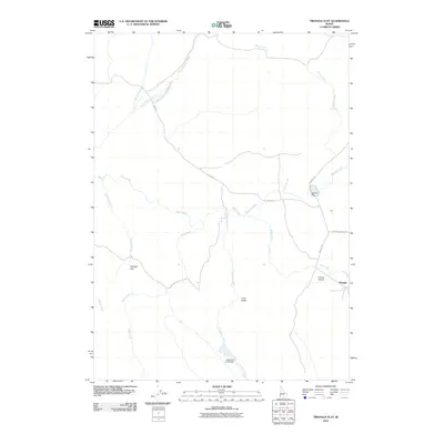
2010 Map of Triangle Flat
USGS Topo · Published 2010About this map
Triangle Flat and the settlement of Triangle occupy a high-desert landscape defined by a complex network of seasonal drainages and remote ranching infrastructure. The area is dominated by the intersection of several notable watercourses, including Rock Creek, Rose Creek, and Josephine Creek, which flows into the Josephine Creek Dam at the southern edge of the quadrangle. This 2010 survey highlights a region shaped by limited access and water management, evidenced by the Spencer Dam and the isolated Triangle Airstrip. Transportation is limited to a few arterial routes like Flint Rd, Triangle Rd, and Antelope Ridge Rd, which traverse the high ground between Long Valley and the steep breaks of North Boulder Creek. The map provides a precise look at the rural character of Owyhee County, where land use is dictated by the availability of water in an arid environment.
Find a feature on this map
18 named features on this map. Tap any name to fly to it.
Don’t see what you’re looking for? This feature index may not catch every label — zoom into the map to look around manually.
Map Details
Editions of this 2010 Triangle Flat Map
This is the sole edition of this map. No revisions or reprints were ever made.
Other maps of this area

1955 · Jordan Valley
USGS Topo · 1:250,000

1957 · Jordan Valley
USGS Topo · 1:250,000

1958 · Jordan Valley
USGS Topo · 1:250,000

1965 · Triangle
USGS Topo · 1:62,500

1965 · Flint Creek
USGS Topo · 1:62,500

1973 · Indian Meadows
USGS Topo · 1:24,000

1973 · Hurry Up Creek
USGS Topo · 1:24,000

1973 · Wickiup Creek
USGS Topo · 1:24,000
1990 · Triangle
USGS Topo · 1:100,000
1990 · Toy Pass
USGS Topo · 1:24,000