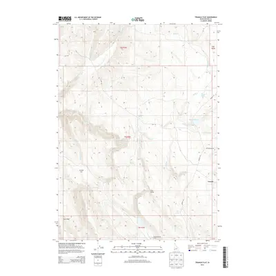
2013 Map of Triangle Flat
USGS Topo · Published 2013About this map
Triangle sits in the high desert of Owyhee County, marking a sparse ranching landscape where water sources dictate the geography of human activity. The terrain is defined by dramatic elevation changes, moving from the broad expanse of Triangle Flat and Long Valley toward the prominent Rose Ridge in the south. This area is heavily dependent on a network of named springs, including Florence Spring, Hardiman Spring, and Chimney Spring, which feed into the seasonal flow of Josephine Cr and Triangle Cr. The map reveals the infrastructure of remote range management, highlighting the Josephine Ranch Airport as a vital link for this isolated community. Historic transportation routes like Flint Rd and Triangle Rd connect the scattered reservoirs, such as Spencer Reservoir and Twin Valley Res, which serve as critical landmarks in a region dominated by vast open grazing lands and rugged drainage basins.
Find a feature on this map
27 named features on this map. Tap any name to fly to it.
Don’t see what you’re looking for? This feature index may not catch every label — zoom into the map to look around manually.
Map Details
Editions of this 2013 Triangle Flat Map
This is the sole edition of this map. No revisions or reprints were ever made.
Other maps of this area

1955 · Jordan Valley
USGS Topo · 1:250,000

1957 · Jordan Valley
USGS Topo · 1:250,000

1958 · Jordan Valley
USGS Topo · 1:250,000

1965 · Triangle
USGS Topo · 1:62,500

1965 · Flint Creek
USGS Topo · 1:62,500

1973 · Indian Meadows
USGS Topo · 1:24,000

1973 · Hurry Up Creek
USGS Topo · 1:24,000

1973 · Wickiup Creek
USGS Topo · 1:24,000
1990 · Triangle
USGS Topo · 1:100,000
1990 · Toy Pass
USGS Topo · 1:24,000