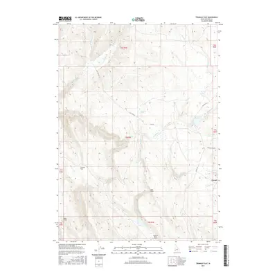
2017 Map of Triangle Flat
USGS Topo · Published 2017About this map
Triangle and the expansive basin of Triangle Flat define this high-desert ranching landscape in Owyhee County. The area’s water management is evident through a series of namesake water sources such as Florence Spring, Chimney Spring, and Hardiman Spring, which feed into various drainages like Josephine Cr and Rock Cr. The map reveals a remote pastoral infrastructure, anchored by the Josephine Ranch Airport in the south and the small settlement at Triangle. High ground is marked by Rose Ridge and the contours overlooking Long Valley. Significant ranching roads, including Flint Rd and Triangle Rd, provide the primary connections across this terrain. Small-scale water storage projects like Spencer Reservoir and Twin Valley Reservoir underscore the critical importance of water rights and irrigation in this corner of Idaho.
Find a feature on this map
31 named features on this map. Tap any name to fly to it.
Don’t see what you’re looking for? This feature index may not catch every label — zoom into the map to look around manually.
Map Details
Editions of this 2017 Triangle Flat Map
This is the sole edition of this map. No revisions or reprints were ever made.
Other maps of this area

1955 · Jordan Valley
USGS Topo · 1:250,000

1957 · Jordan Valley
USGS Topo · 1:250,000

1958 · Jordan Valley
USGS Topo · 1:250,000

1965 · Triangle
USGS Topo · 1:62,500

1965 · Flint Creek
USGS Topo · 1:62,500

1973 · Indian Meadows
USGS Topo · 1:24,000

1973 · Hurry Up Creek
USGS Topo · 1:24,000

1973 · Wickiup Creek
USGS Topo · 1:24,000
1990 · Triangle
USGS Topo · 1:100,000
1990 · Toy Pass
USGS Topo · 1:24,000