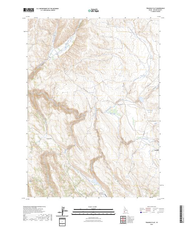
2023 Map of Triangle Flat
USGS Topo · Published 2023About this map
Triangle Flat and the surrounding high country of Owyhee County are defined by a network of seasonal drainages and remote ranching infrastructure. This modern survey illustrates the rugged drainage patterns of Rock Creek and Josephine Creek, which carve through the plateau toward Twin Valley Reservoir. The landscape is dotted with critical water sources for high-desert ranching, including Hardiman Spring, Chimney Spring, and Florence Spring, essential landmarks in this arid environment. The small settlement of Triangle sits at the junction of Triangle Rd and Antelope Ridge Rd, serving as a central point in a territory otherwise dominated by topographical features like Rose Ridge and the expansive Long Valley. The presence of the Josephine Ranch Airport in the southern portion of the quadrangle highlights the continued reliance on private aviation for access to these isolated Idaho ranchlands.
Find a feature on this map
31 named features on this map. Tap any name to fly to it.
Don’t see what you’re looking for? This feature index may not catch every label — zoom into the map to look around manually.
Map Details
Editions of this 2023 Triangle Flat Map
This is the sole edition of this map. No revisions or reprints were ever made.
Other maps of this area

1955 · Jordan Valley
USGS Topo · 1:250,000

1957 · Jordan Valley
USGS Topo · 1:250,000

1958 · Jordan Valley
USGS Topo · 1:250,000

1965 · Triangle
USGS Topo · 1:62,500

1965 · Flint Creek
USGS Topo · 1:62,500

1973 · Indian Meadows
USGS Topo · 1:24,000

1973 · Hurry Up Creek
USGS Topo · 1:24,000

1973 · Wickiup Creek
USGS Topo · 1:24,000
1990 · Triangle
USGS Topo · 1:100,000
1990 · Toy Pass
USGS Topo · 1:24,000