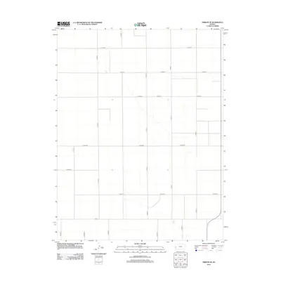
2012 Map of Tribune SE
USGS Topo · Published 2012About this map
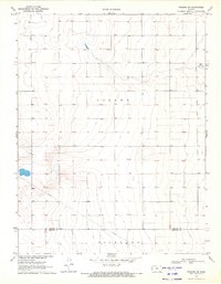
Tribune Township in western Kansas presents a strictly geometric landscape defined by the Public Land Survey System, as seen in this 2012 topographic study. The area is characterized by an expansive grid of section-line roads, such as Co Road X and Co Road Bb, which facilitate movement through the high plains. North-south thoroughfares like Co Rd-12 and Co Rd-14 segment the terrain into uniform agricultural blocks, a hallmark of the Great Plains' rural infrastructure. This mapping by the U. S. Geological Survey illustrates the transition from traditional section roads to modern county-maintained routes like Co Rd-1 at the township's southern edge. The lack of named settlements or water bodies underscores the specialized nature of this agricultural landscape, where the road network itself is the primary indicator of human activity and property division.
Find a feature on this map
18 named features on this map. Tap any name to fly to it.
Don’t see what you’re looking for? This feature index may not catch every label — zoom into the map to look around manually.
Map Details
Editions of this 2012 Tribune SE Map
This is the sole edition of this map. No revisions or reprints were ever made.
Other maps of this area

1955 · Scott City
USGS Topo · 1:250,000

1958 · Scott City
USGS Topo · 1:250,000

1966 · Tribune 4 NW
USGS Topo · 1:24,000
1966 · Tribune 3 NE
USGS Topo · 1:24,000
1966 · Tribune 3 NW
USGS Topo · 1:24,000

1970 · Selkirk SW
USGS Topo · 1:24,000

1970 · Selkirk NW
USGS Topo · 1:24,000
1970 · Tribune NW
USGS Topo · 1:24,000

1970 · Tribune SE
USGS Topo · 1:24,000
1970 · Tribune SW
USGS Topo · 1:24,000