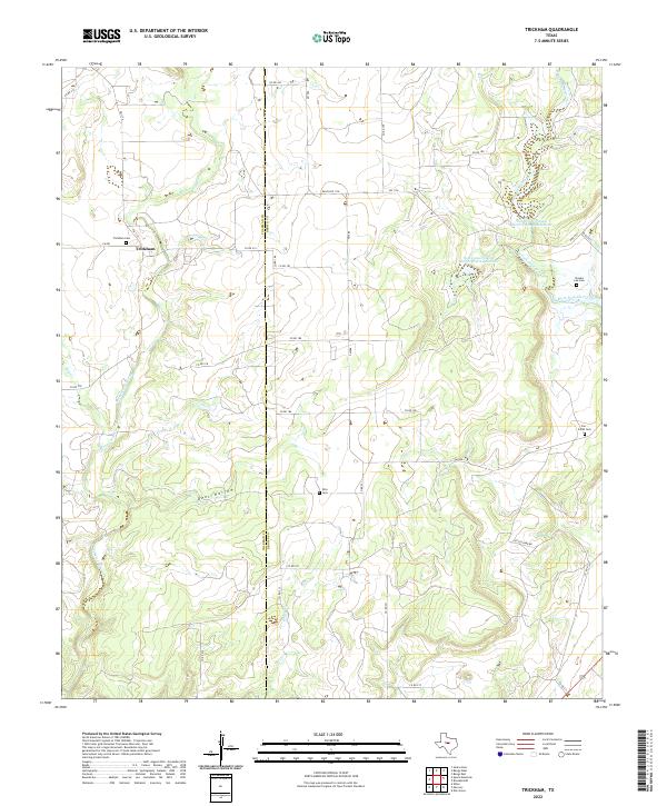
2022 Map of Trickham
USGS Topo · Published 2022About this map
Trickham sits at the junction of FM 1176 and FM RD in this 2022 survey of the Coleman Co and Brown Co borderlands. The landscape is defined by the winding course of Mukewater Creek and the western reaches of Deer Hollow, presenting a classic West Texas ranching environment. For genealogists and local historians, several family and community landmarks are clearly documented, including the Trickham Cem, Rice Cem, Brooks Lee Cem, and the Carr - Smith Cem. These sites, scattered across the rolling terrain, provide a record of rural settlement patterns along the waterways.
Find a feature on this map
38 named features on this map. Tap any name to fly to it.
Don’t see what you’re looking for? This feature index may not catch every label — zoom into the map to look around manually.
Map Details
Editions of this 2022 Trickham Map
This is the sole edition of this map. No revisions or reprints were ever made.
Other maps of this area

1887 · Coleman
USGS Topo · 1:125,000

1889 · Coleman
USGS Topo · 1:125,000

1894 · Brady
USGS Topo · 1:125,000

1924 · Brady 2-a
USGS Topo · 1:48,000

1925 · Brady 1-b
USGS Topo · 1:48,000

1925 · Brady 1-a
USGS Topo · 1:48,000

1928 · Mercury
USGS Topo · 1:62,500

1928 · Waldrip
USGS Topo · 1:62,500

1950 · Mercury
USGS Topo · 1:62,500

1954 · Brownwood
USGS Topo · 1:250,000