
1954 Map of Trigo Peaks
USGS Topo · Published 1955About this map
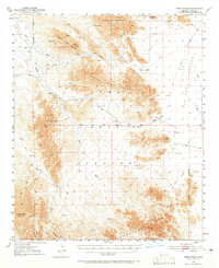
The Dome Rock Mountains and the jagged ridges of the North Trigo Peaks dominate this mid-century desert landscape within the Military Reservation. This terrain is defined by a complex network of seasonal drainages, where Trigo Wash and Mohave Wash cut through the arid plains toward the Colorado River valley. The geography here is marked by essential water sources for desert travel, including Mohave Tanks and White Tanks, which historically provided relief for those navigating the old trails between the peaks. In the southern portion of the map, the Chocolate Mts rise above the McAllister Wash, while signs of mineral exploration appear at the Tweed Mine and various unnamed prospects. This 1954 revision documents a network of primitive transportation routes, including the Mohave Road and the Gila and Salt River Base Line Road, showing how travel was managed across the La Posa Plain through natural gaps like Felipe Pass.
Find a feature on this map
28 named features on this map. Tap any name to fly to it.
Don’t see what you’re looking for? This feature index may not catch every label — zoom into the map to look around manually.
Map Details
Editions of this 1954 Trigo Peaks Map
3 editions found
Other maps of this area

1933 · Cunningham Mtn
USGS Topo · 1:48,000

1934 · Trigo Peaks
USGS Topo · 1:48,000

1939 · Red Hill
USGS Topo · 1:62,500

1939 · Trigo Peaks
USGS Topo · 1:62,500

1940 · Dome Rock Mts
USGS Topo · 1:62,500

1942 · Blythe
USGS Topo · 1:250,000

1945 · Cibola
USGS Topo · 1:62,500

1945 · Picacho
USGS Topo · 1:62,500

1951 · Picacho
USGS Topo · 1:62,500

1951 · Blythe
USGS Topo · 1:24,000