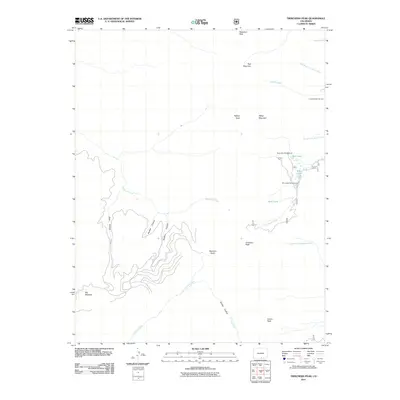
2011 Map of Trinchera Peak
USGS Topo · Published 2011About this map
Trinchera Peak anchors this high-elevation corner of the Sangre de Cristo Mountains in southern Colorado, where the headwaters of several major regional drainages begin. The topography is defined by sharp ridgelines and deep glacial carvings, including Beccerro Basin and Big Meadow. These alpine environments serve as a primary water source, feeding Trinchera Creek to the west and the North Fork Purgatoire River and Cucharas Creek to the east.
Find a feature on this map
26 named features on this map. Tap any name to fly to it.
Don’t see what you’re looking for? This feature index may not catch every label — zoom into the map to look around manually.
Map Details
Editions of this 2011 Trinchera Peak Map
This is the sole edition of this map. No revisions or reprints were ever made.
Other maps of this area

1954 · Trinidad
USGS Topo · 1:250,000

1955 · Trinidad
USGS Topo · 1:250,000

1958 · Trinidad
USGS Topo · 1:250,000

1959 · Trinidad
USGS Topo · 1:250,000

1963 · Mc Carty Park
USGS Topo · 1:24,000
1963 · Cuchara
USGS Topo · 1:24,000

1967 · Ojito Peak
USGS Topo · 1:24,000
1967 · Cucharas Pass
USGS Topo · 1:24,000
1967 · Trinchera Ranch
USGS Topo · 1:24,000

1967 · Taylor Ranch
USGS Topo · 1:24,000