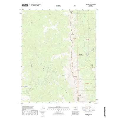
2019 Map of Trinchera Peak
USGS Topo · Published 2019About this map
Trinchera Peak stands as the dominant sentinel at the intersection of Huerfano, Costilla, and Las Animas counties, anchoring a high-altitude landscape defined by the drainage divide between the Purgatoire and Cucharas river systems. Within the San Isabel National Forest, the topography transitions from the steep grades of Deep Canyon and Apache Canyon to subalpine basins such as Beccerro Basin. The 2019 survey delineates the intricate headwaters of the N Fork Purgatoire River and Hill Br Cucharas River, showing how water moves through high-mountain features like Blue Lakes and Wolf Lake. Land management boundaries are carefully noted, including the convergence of several townships such as t31s r70w and t31s r69w. The map provides a precise view of the remote corridors used for forest access, including Doyle Rd and the high-elevation Blue Bear Road (Snow).
Find a feature on this map
42 named features on this map. Tap any name to fly to it.
Don’t see what you’re looking for? This feature index may not catch every label — zoom into the map to look around manually.
Map Details
Editions of this 2019 Trinchera Peak Map
This is the sole edition of this map. No revisions or reprints were ever made.
Other maps of this area

1954 · Trinidad
USGS Topo · 1:250,000

1955 · Trinidad
USGS Topo · 1:250,000

1958 · Trinidad
USGS Topo · 1:250,000

1959 · Trinidad
USGS Topo · 1:250,000

1963 · Mc Carty Park
USGS Topo · 1:24,000
1963 · Cuchara
USGS Topo · 1:24,000

1967 · Ojito Peak
USGS Topo · 1:24,000
1967 · Cucharas Pass
USGS Topo · 1:24,000
1967 · Trinchera Ranch
USGS Topo · 1:24,000

1967 · Taylor Ranch
USGS Topo · 1:24,000