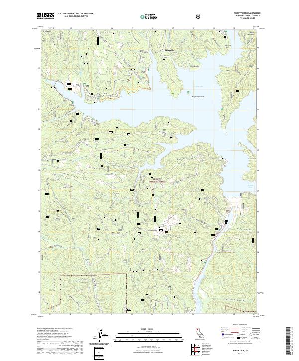
2022 Map of Trinity Dam
USGS Topo · Published 2022About this map
Trinity Lake dominates the upper half of this modern topographical survey, reaching its long fingers into the many gulches and canyons of the Trinity National Forest. The map documents a landscape defined by water and altitude, where the submerged terrain of the Papoose Arm and Ridgeville Islands contrasts with the surrounding mountain ridges. For genealogists and local historians, the northern portion of the map preserves the location of Ridgeville and the Ridgeville Cem, alongside several named flats such as Hayward Flat and Chicken Flat.
Find a feature on this map
73 named features on this map. Tap any name to fly to it.
Don’t see what you’re looking for? This feature index may not catch every label — zoom into the map to look around manually.
Map Details
Editions of this 2022 Trinity Dam Map
This is the sole edition of this map. No revisions or reprints were ever made.
Other maps of this area

1890 · Red Bluff
USGS Topo · 1:250,000

1894 · Red Bluff
USGS Topo · 1:250,000

1913 · Weaverville
USGS Topo · 1:125,000

1944 · French Gulch
USGS Topo · 1:62,500

1948 · French Gulch
USGS Topo · 1:62,500

1950 · Minersville
USGS Topo · 1:62,500

1950 · Schell Mtn
USGS Topo · 1:62,500

1950 · Weaverville
USGS Topo · 1:62,500
1952 · Schell Mtn.
USGS Topo · 1:62,500

1952 · Weaverville
USGS Topo · 1:62,500