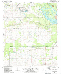
1987 Map of Trinity
USGS Topo · Published 1987About this map
The Tennessee-Tombigbee Waterway and Aliceville Lake dominate the eastern landscape of this Lowndes County region, marking the late-century transformation of the historic river corridor. Near the northern boundary, a large Industrial Plant and its associated Conveyor and Levee system highlight the modern infrastructure supporting the waterway. Despite these industrial advancements, the rural character remains through scattered settlements and family-named landmarks like Hairston Bend and Zion Hill.
Find a feature on this map
45 named features on this map. Tap any name to fly to it.
Don’t see what you’re looking for? This feature index may not catch every label — zoom into the map to look around manually.
Map Details
Editions of this 1987 Trinity Map
This is the sole edition of this map. No revisions or reprints were ever made.
Other maps of this area

1953 · West Point
USGS Topo · 1:250,000

1958 · West Point
USGS Topo · 1:250,000

1959 · Artesia
USGS Topo · 1:62,500

1960 · Columbus
USGS Topo · 1:62,500

1963 · West Point
USGS Topo · 1:250,000

1973 · Cliftonville
USGS Topo · 1:24,000
1973 · Brooksville
USGS Topo · 1:24,000
1974 · Pickensville
USGS Topo · 1:24,000

1984 · West Point
USGS Topo · 1:250,000
1987 · Columbus South
USGS Topo · 1:24,000