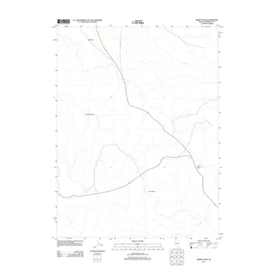
2011 Map of Trinity Pass
USGS Topo · Published 2011About this map
Trinity Range dominate the southern portion of this desert landscape in Pershing County, Nevada. The high mountain terrain transitions into the wide expanse of Sage Valley to the north, a characteristic basin-and-range formation typical of this region of the Great Basin. Trinity Pass serves as a primary geographic notch through the mountains, facilitating movement through the high country. The road network is sparse, defined by the winding path of 7 Troughs Rd which navigates the alluvial fans and drainage patterns of the valley floor. To the west, the deeply cut topography of Toll Rock Canyon marks the rugged transition from the mountain slopes to the sagebrush-covered flats, illustrating the remote and arid character of the Nevada interior in the early 21st century.
Find a feature on this map
5 named features on this map. Tap any name to fly to it.
Don’t see what you’re looking for? This feature index may not catch every label — zoom into the map to look around manually.
Map Details
Editions of this 2011 Trinity Pass Map
This is the sole edition of this map. No revisions or reprints were ever made.
Other maps of this area

1931 · Lovelock
USGS Topo · 1:250,000

1935 · Lovelock
USGS Topo · 1:250,000

1955 · Lovelock
USGS Topo · 1:250,000

1956 · Toulon
USGS Topo · 1:62,500

1959 · Lovelock
USGS Topo · 1:250,000
1981 · Seven Troughs
USGS Topo · 1:24,000

1981 · Natchez Spring
USGS Topo · 1:24,000

1981 · Trinity Pass
USGS Topo · 1:24,000

1981 · Poker Brown Spring
USGS Topo · 1:24,000
1981 · Trinity Pass NW
USGS Topo · 1:24,000