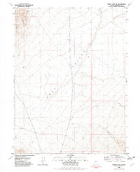
1981 Map of Trinity Pass NW
USGS Topo · Published 1982About this map
The Seven Troughs Range dominates the western edge of this Pershing County landscape, giving way to the broad alluvial plains of Sage Valley. This 1981 survey, based on 1974 aerial photography, reveals a remote desert environment defined by seasonal drainages and early mining interest. A single prospect is located near the northern peaks of the range, while several 4wd tracks provide the only established routes through the sagebrush. The terrain is marked by significant elevation shifts, from the heights near Burnt Canyon down into the expansive valley floor. Deep cut features like Poker Brown Canyon and Willow Canyon illustrate the erosional patterns of the Great Basin, where rare water events have carved paths through the dry soil. This map documents a quiet, industrial-adjacent wilderness where land use is limited to small-scale extraction, evidenced by a solitary Borrow Pit in the central basin.
Find a feature on this map
9 named features on this map. Tap any name to fly to it.
Don’t see what you’re looking for? This feature index may not catch every label — zoom into the map to look around manually.
Map Details
Editions of this 1981 Trinity Pass NW Map
This is the sole edition of this map. No revisions or reprints were ever made.
Other maps of this area

1931 · Lovelock
USGS Topo · 1:250,000

1935 · Lovelock
USGS Topo · 1:250,000

1955 · Lovelock
USGS Topo · 1:250,000

1959 · Lovelock
USGS Topo · 1:250,000
1981 · Seven Troughs
USGS Topo · 1:24,000

1981 · Natchez Spring
USGS Topo · 1:24,000

1981 · Trinity Pass
USGS Topo · 1:24,000
1981 · Poker Brown Gap
USGS Topo · 1:24,000

1981 · Poker Brown Spring
USGS Topo · 1:24,000
1981 · Seven Troughs SE
USGS Topo · 1:24,000