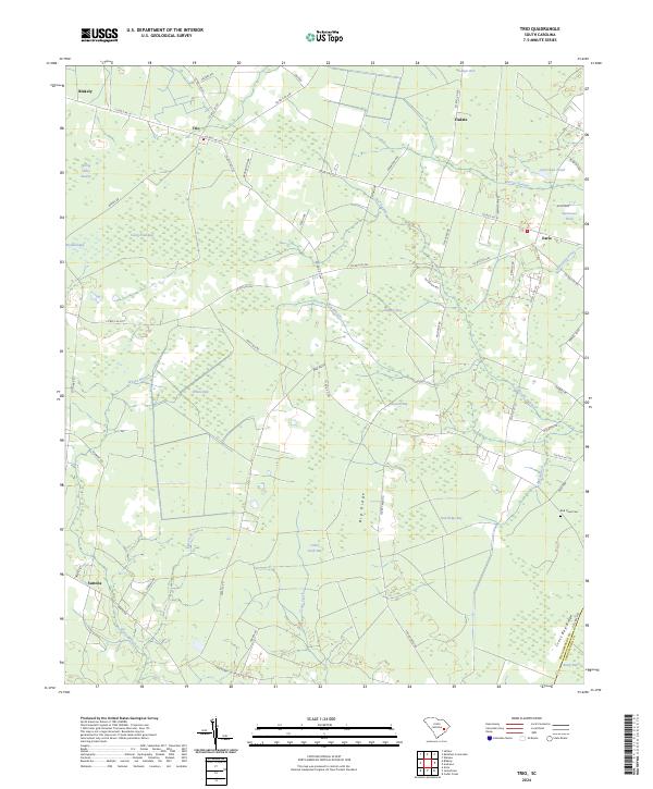
2024 Map of Trio
USGS Topo · Published 2024About this map
Trio and its surrounding communities in Williamsburg County are defined by a complex mosaic of Carolina bays and wetlands in this 2024 survey. The geography is characterized by numerous elliptical depressions such as Ricefield Bay, Camp Pond Bay, and Wittee Bay, which alternate with drier elevations like Big Ridge and Cross Bay Ridge. This pattern of land use shows how local infrastructure, including roads like Salters Rd and Santee Rd, navigates the hydrologic network formed by Murray Swamp and Johnsons Swamp.
Find a feature on this map
66 named features on this map. Tap any name to fly to it.
Don’t see what you’re looking for? This feature index may not catch every label — zoom into the map to look around manually.
Map Details
Editions of this 2024 Trio Map
This is the sole edition of this map. No revisions or reprints were ever made.
Other maps of this area

1942 · Cedar Creek
USGS Topo · 1:24,000

1943 · Trio
USGS Topo · 1:24,000

1943 · Andrews
USGS Topo · 1:24,000

1943 · Jamestown
USGS Topo · 1:24,000

1943 · Bonneau
USGS Topo · 1:62,500

1946 · Kingstree
USGS Topo · 1:62,500

1946 · Indiantown
USGS Topo · 1:62,500

1949 · Georgetown
USGS Topo · 1:250,000

1967 · Georgetown
USGS Topo · 1:250,000

1974 · Georgetown
USGS Topo · 1:250,000