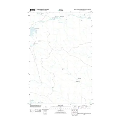
2011 Map of Triple Crossing Reservoir East
USGS Topo · Published 2011About this map
Lone Tree Creek and Hard Pan Creek define the drainage patterns of this Valley County landscape, where water management is central to the land's utility. The area is characterized by an extensive network of small-scale reservoirs and dams, reflecting a concentrated effort to capture seasonal runoff in an arid environment. Notable examples include the Triple Crossing Reservoir, controlled by the Triple Crossing Dam, and the Willow Bunch Reservoir. This 2011 survey documents a topography where infrastructure like the Triple Crossing Water Spreaders Dam and the Corral Junction Dam supports local agricultural or ranching needs. The map also captures named local landmarks such as Gravel Hill Dam and Dividend Dam, providing a clear record of the specific engineering features used to navigate the hydraulic challenges of the Montana plains.
Find a feature on this map
27 named features on this map. Tap any name to fly to it.
Don’t see what you’re looking for? This feature index may not catch every label — zoom into the map to look around manually.
Map Details
Editions of this 2011 Triple Crossing Reservoir East Map
This is the sole edition of this map. No revisions or reprints were ever made.
Other maps of this area

1943 · Glasgow
USGS Topo · 1:125,000

1954 · Jordan
USGS Topo · 1:250,000

1954 · Glasgow
USGS Topo · 1:250,000

1956 · Jordan
USGS Topo · 1:250,000

1957 · Glasgow
USGS Topo · 1:250,000

1958 · Glasgow
USGS Topo · 1:250,000

1958 · Jordan
USGS Topo · 1:250,000

1958 · Miller Coulee
USGS Topo · 1:62,500

1958 · Collins Ranch
USGS Topo · 1:62,500

1964 · Jordan
USGS Topo · 1:250,000