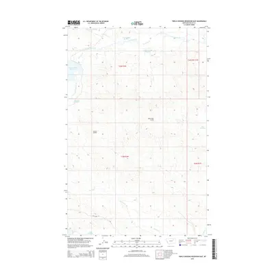
2014 Map of Triple Crossing Reservoir East
USGS Topo · Published 2014About this map
The high plains of Valley County are defined by a sophisticated system of water management and drainage captured in this 2014 survey. This arid landscape is punctuated by numerous catchment points, including Twin Forks Reservoir, Willow Bunch Reservoir, and Triple Crossing Reservoir, which reflect the region's reliance on stored water for livestock and land use. The drainage network is anchored by Lone Tree Creek in the north and Hard Pan Cr in the south, carving distinct features into the terrain such as White Rock Coulee and Corral Coulee. Human presence is sparse, marked primarily by the administrative grid of the Public Land Survey System and isolated infrastructure like Stone House Rd. Smaller water bodies like Whitetail Reservoir and Camp Reservoir further illustrate how the geography has been adapted to sustain life in this corner of Montana.
Find a feature on this map
19 named features on this map. Tap any name to fly to it.
Don’t see what you’re looking for? This feature index may not catch every label — zoom into the map to look around manually.
Map Details
Editions of this 2014 Triple Crossing Reservoir East Map
This is the sole edition of this map. No revisions or reprints were ever made.
Other maps of this area

1943 · Glasgow
USGS Topo · 1:125,000

1954 · Jordan
USGS Topo · 1:250,000

1954 · Glasgow
USGS Topo · 1:250,000

1956 · Jordan
USGS Topo · 1:250,000

1957 · Glasgow
USGS Topo · 1:250,000

1958 · Glasgow
USGS Topo · 1:250,000

1958 · Jordan
USGS Topo · 1:250,000

1958 · Miller Coulee
USGS Topo · 1:62,500

1958 · Collins Ranch
USGS Topo · 1:62,500

1964 · Jordan
USGS Topo · 1:250,000