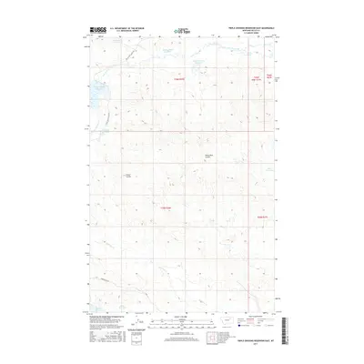
2017 Map of Triple Crossing Reservoir East
USGS Topo · Published 2017About this map
Twin Forks Reservoir and Willow Bunch Reservoir anchor the northern landscape of this Valley County map, part of an extensive network of water catchments developed in this arid region. The drainage patterns are defined by the winding course of Lone Tree Creek and its tributary, S Fork Lone Tree Cr, which feed into series of small impoundments such as Triple Crossing Reservoir and Whitetail Reservoir. This 2017 survey reveals the reliance on local water management through named reservoirs like Skull Reservoir and Halfpint Reservoir located near the southern border. Access through the rangeland is provided by utilitarian routes including Triple Cross Access Rd and Stone House Rd, while geological features like White Rock Coulee and Corral Coulee offer distinct landmarks across the open terrain.
Find a feature on this map
21 named features on this map. Tap any name to fly to it.
Don’t see what you’re looking for? This feature index may not catch every label — zoom into the map to look around manually.
Map Details
Editions of this 2017 Triple Crossing Reservoir East Map
This is the sole edition of this map. No revisions or reprints were ever made.
Other maps of this area

1943 · Glasgow
USGS Topo · 1:125,000

1954 · Jordan
USGS Topo · 1:250,000

1954 · Glasgow
USGS Topo · 1:250,000

1956 · Jordan
USGS Topo · 1:250,000

1957 · Glasgow
USGS Topo · 1:250,000

1958 · Glasgow
USGS Topo · 1:250,000

1958 · Jordan
USGS Topo · 1:250,000

1958 · Miller Coulee
USGS Topo · 1:62,500

1958 · Collins Ranch
USGS Topo · 1:62,500

1964 · Jordan
USGS Topo · 1:250,000