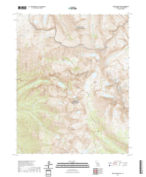
2021 Map of Triple Divide Peak
USGS Topo · Published 2021About this map
Triple Divide Peak stands as the hydrographic centerpiece of this High Sierra landscape, where the headwaters of the Kern-Kaweah River, Roaring River, and Middle Fork Kaweah River diverge. This 2021 survey documents a high-altitude wilderness within the borders of Kings Canyon National Park and Sequoia National Park. The map captures the sheer verticality of the Great Western Divide and the Kaweah Peaks Ridge, featuring prominent summits such as Black Kaweah, Red Kaweah, and Mt Stewart. Significant alpine destinations like Valhalla and the Nine Lake Basin are shown alongside established backcountry routes, including the Hamilton Lakes Trl and the Twenty-Seven Switchback Cut Off Trl. This modern record of the Sierra Nevada crest provides a definitive view of the topography surrounding Bearpaw Meadow and the historic Copper Mine Pass.
Find a feature on this map
65 named features on this map. Tap any name to fly to it.
Don’t see what you’re looking for? This feature index may not catch every label — zoom into the map to look around manually.
Map Details
Editions of this 2021 Triple Divide Peak Map
This is the sole edition of this map. No revisions or reprints were ever made.
Other maps of this area

1903 · Tehipite
USGS Topo · 1:125,000

1904 · Kaweah
USGS Topo · 1:125,000

1905 · Tehipite
USGS Topo · 1:125,000

1905 · Olancha
USGS Topo · 1:125,000

1907 · Olancha
USGS Topo · 1:125,000

1907 · Mt. Whitney
USGS Topo · 1:125,000

1909 · Kaweah
USGS Topo · 1:125,000

1919 · Mt. Whitney
USGS Topo · 1:125,000

1937 · Mt. Whitney
USGS Topo · 1:125,000

1937 · Kaweah
USGS Topo · 1:125,000