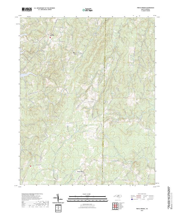
2022 Map of Triple Springs
USGS Topo · Published 2022About this map
The Tar River and its numerous tributaries, including Shelton Cr and Donaldson Cr, define the rolling landscape of the border between Person and Granville counties. This recent survey of the region around Triple Springs reveals a network of roads named for local families and landmarks, such as Witt Brothers Rd and Faulkner-Long Rd. The presence of Dirgie Mine Rd and Pulliam Tingen Mine Rd points to the area's legacy of resource extraction, while the Olive Branch Baptist Church Cem serves as a significant site for genealogical research. To the west, the waters of Mayo Reservoir reach into the quadrangle, contrasting with the narrow stream valleys and ridges like Moonshine Ridge that characterize the interior rural terrain near Denny Store.
Find a feature on this map
78 named features on this map. Tap any name to fly to it.
Don’t see what you’re looking for? This feature index may not catch every label — zoom into the map to look around manually.
Map Details
Editions of this 2022 Triple Springs Map
This is the sole edition of this map. No revisions or reprints were ever made.
Other maps of this area

1941 · Clarksville
USGS Topo · 1:48,000

1943 · Clarksville
USGS Topo · 1:62,500

1943 · Roxboro
USGS Topo · 1:62,500

1953 · Oxford
USGS Topo · 1:62,500

1953 · South Boston
USGS Topo · 1:62,500

1953 · Greensboro
USGS Topo · 1:250,000

1954 · Greensboro
USGS Topo · 1:250,000

1957 · South Boston
USGS Topo · 1:62,500

1957 · Clarksville
USGS Topo · 1:62,500

1962 · Greensboro
USGS Topo · 1:250,000