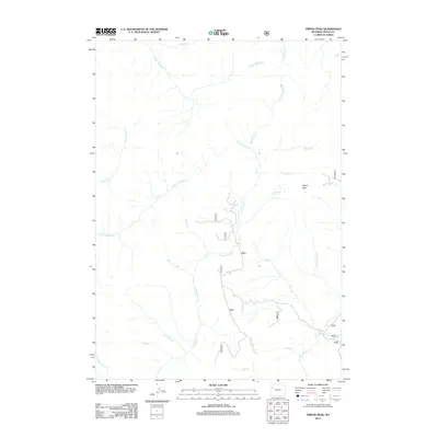
2012 Map of Tripod Peak
USGS Topo · Published 2012About this map
Tripod Peak serves as the literal and metaphorical high point of this Teton County drainage basin, anchoring a landscape defined by the convergence of the N Fork Spread Cr and S Fork Spread Cr. The terrain is characterized by a dense network of high-altitude tributaries, including the aptly named Two Water Cr and the cascading waters of Falls Cr. This 2012 survey illustrates the remote wilderness character of the region, where a complex system of Forest Service roads provides the only human access through the canyons. Notable waterways such as Cottonwood Cr and Hardscrabble Cr carve through the mountain slopes, while the eastern edge is marked by the presence of Beauty Park Cr. The intricate hydrography, featuring names like Solitare Cr and Poison Cr, highlights the isolation and environmental specifics of this Wyoming backcountry.
Find a feature on this map
32 named features on this map. Tap any name to fly to it.
Don’t see what you’re looking for? This feature index may not catch every label — zoom into the map to look around manually.
Map Details
Editions of this 2012 Tripod Peak Map
This is the sole edition of this map. No revisions or reprints were ever made.
Other maps of this area

1902 · Mt Leidy
USGS Topo · 1:125,000

1955 · Driggs
USGS Topo · 1:250,000

1958 · Driggs
USGS Topo · 1:250,000

1962 · Driggs
USGS Topo · 1:250,000

1965 · Green Mountain
USGS Topo · 1:24,000
1965 · Lava Mountain
USGS Topo · 1:24,000

1965 · Rosies Ridge
USGS Topo · 1:24,000
1965 · Sheridan Pass
USGS Topo · 1:24,000
1965 · Upper Slide Lake
USGS Topo · 1:24,000

1965 · Tripod Peak
USGS Topo · 1:24,000