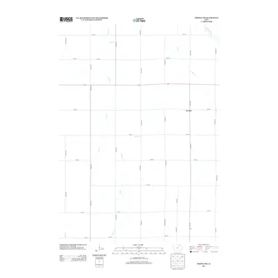
2013 Map of Tripoli NW
USGS Topo · Published 2013About this map
Republic and Pony anchor this agricultural landscape in Chickasaw County, where the geometric grid of Iowa section lines is interrupted only by the meandering paths of local waterways. The northern reach of the Wapsipinicon River clips the northeastern corner, while the remainder of the terrain is drained by a network of smaller streams including Etter Cr, Horton Cr, and the appropriately named Dry Run. This area remains deeply rooted in a rural layout defined by named avenues like Cheyenne Ave and Fairview Ave, reflecting the persistent land-use patterns of the American Midwest. The map reveals the intersection of state transit and local life, with Iowa Highway 346 cutting horizontally across the township, providing a primary link for these small prairie communities and outlying farmsteads.
Find a feature on this map
31 named features on this map. Tap any name to fly to it.
Don’t see what you’re looking for? This feature index may not catch every label — zoom into the map to look around manually.
Map Details
Editions of this 2013 Tripoli NW Map
This is the sole edition of this map. No revisions or reprints were ever made.
Other maps of this area

1954 · Mason City
USGS Topo · 1:250,000

1954 · Waterloo
USGS Topo · 1:250,000

1955 · Waterloo
USGS Topo · 1:250,000

1957 · Mason City
USGS Topo · 1:250,000

1958 · Mason City
USGS Topo · 1:250,000

1971 · Bremer
USGS Topo · 1:24,000

1971 · Tripoli NW
USGS Topo · 1:24,000

1971 · Plainfield
USGS Topo · 1:24,000

1971 · Frederika
USGS Topo · 1:24,000

1971 · Bassett
USGS Topo · 1:24,000