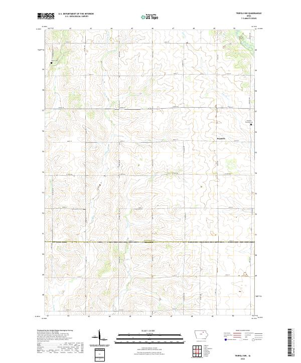
2022 Map of Tripoli NW
USGS Topo · Published 2022About this map
Republic sits near the heart of this agricultural landscape in Chickasaw and Bremer Counties, surrounded by a meticulously surveyed grid of township and range lines. The terrain is defined by a network of drainage ways including Twomile Creek, Dry Run, and Horton Creek, which carve subtle elevations into the prairie. This area reflects a long history of rural settlement, preserved here in the location of Cagley Cemetery and Richland Township Cemetery. The map documents the persistent layout of section-line roads, such as County Highway B66 and County Road V14, which continue to dictate the movement of commerce and people across the Iowa countryside.
Find a feature on this map
36 named features on this map. Tap any name to fly to it.
Don’t see what you’re looking for? This feature index may not catch every label — zoom into the map to look around manually.
Map Details
Editions of this 2022 Tripoli NW Map
This is the sole edition of this map. No revisions or reprints were ever made.
Other maps of this area

1954 · Mason City
USGS Topo · 1:250,000

1954 · Waterloo
USGS Topo · 1:250,000

1955 · Waterloo
USGS Topo · 1:250,000

1957 · Mason City
USGS Topo · 1:250,000

1958 · Mason City
USGS Topo · 1:250,000

1971 · Bremer
USGS Topo · 1:24,000

1971 · Tripoli NW
USGS Topo · 1:24,000

1971 · Plainfield
USGS Topo · 1:24,000

1971 · Frederika
USGS Topo · 1:24,000

1971 · Bassett
USGS Topo · 1:24,000