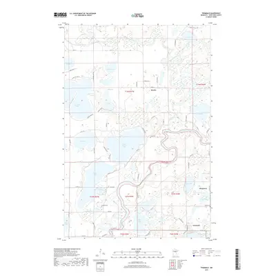
2019 Map of Trommald
USGS Topo · Published 2019About this map
Mississippi River oxbows through the center of this Crow Wing County landscape, defining the transition between the lake-rich north and the industrial and cemetery sites to the south. The area is anchored by the small settlements of Mission and Trommald, with the latter situated near the edge of the Cuyuna Range iron district. Significant water bodies like Upper Mission Lake, Lower Mission Lake, and Bass Lake dominate the western half, while the Pine River and Pelican Brook drain the northern reaches. For genealogists and local historians, the map identifies specific burial grounds including Mission Cem, Evergreen Cem, and Wolford Cem. The road network, including Co RD 11 and Co RD 19, provides a clear view of the rural development pattern surrounding the vanished mining interest of Manganese.
Find a feature on this map
74 named features on this map. Tap any name to fly to it.
Don’t see what you’re looking for? This feature index may not catch every label — zoom into the map to look around manually.
Map Details
Editions of this 2019 Trommald Map
This is the sole edition of this map. No revisions or reprints were ever made.
Other maps of this area

1912 · Deerwood
USGS Topo · 1:62,500

1913 · Cuyuna
USGS Topo · 1:62,500

1914 · Deerwood
USGS Topo · 1:62,500

1915 · Cuyuna
USGS Topo · 1:62,500

1915 · Brainerd
USGS Topo · 1:62,500

1918 · Brainerd
USGS Topo · 1:62,500

1953 · Duluth
USGS Topo · 1:250,000

1953 · Brainerd
USGS Topo · 1:250,000

1957 · Brainerd
USGS Topo · 1:250,000

1958 · Brainerd
USGS Topo · 1:250,000