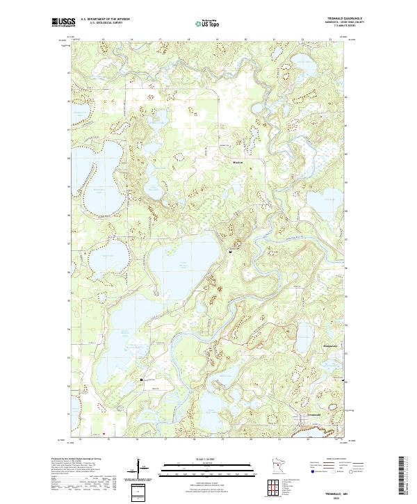
2022 Map of Trommald
USGS Topo · Published 2022About this map
The Mississippi River winds through the central and southern reaches of this landscape, its path mirrored by the Mississippi River Trl as it navigates a region defined by an extensive network of lakes. Settled areas like Mission, Manganese, and Trommald anchor the local geography, each connected by a grid of county roads and trails that traverse the lake-studded terrain. The map captures a moment in the modern era where the residential and recreational development of the Crow Wing County lakelands is well established, with clusters of homes situated along the shores of Upper Mission Lake and Horseshoe Lake.
Find a feature on this map
76 named features on this map. Tap any name to fly to it.
Don’t see what you’re looking for? This feature index may not catch every label — zoom into the map to look around manually.
Map Details
Editions of this 2022 Trommald Map
This is the sole edition of this map. No revisions or reprints were ever made.
Other maps of this area

1912 · Deerwood
USGS Topo · 1:62,500

1913 · Cuyuna
USGS Topo · 1:62,500

1914 · Deerwood
USGS Topo · 1:62,500

1915 · Cuyuna
USGS Topo · 1:62,500

1915 · Brainerd
USGS Topo · 1:62,500

1918 · Brainerd
USGS Topo · 1:62,500

1953 · Duluth
USGS Topo · 1:250,000

1953 · Brainerd
USGS Topo · 1:250,000

1957 · Brainerd
USGS Topo · 1:250,000

1958 · Brainerd
USGS Topo · 1:250,000