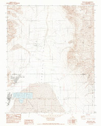
1982 Map of Trona East
USGS Topo · Published 1983About this map
The industrial and mineral landscape of Searles Lake dominates this 1980s topographic study, where the extraction of borax and other minerals shaped the development of Trona and its surrounding communities. The map highlights an extensive network of Evaporators and a Salt Evaporator served by roads on levees and various pipelines. These specialized operations were essential for harvesting salt from the dry lake bed. To the north and west, the terrain rises into the Argus Range and Slate Range, where mining history is marked by the Ophir Mine, Gold Bottom Mine, and Stockwell Mine. This era shows the region during the height of the Cold War, evidenced by the proximity of the China Lake Naval Weapons Center. Small residential clusters at Pioneer Point and Point of Rocks provide a glimpse into the local settlement pattern tied directly to the potash and chemical industries of Searles Valley.
Find a feature on this map
30 named features on this map. Tap any name to fly to it.
Don’t see what you’re looking for? This feature index may not catch every label — zoom into the map to look around manually.
Map Details
Editions of this 1982 Trona East Map
This is the sole edition of this map. No revisions or reprints were ever made.
Other maps of this area

1915 · Searles Lake
USGS Topo · 1:250,000

1947 · Trona
USGS Topo · 1:250,000

1948 · Trona
USGS Topo · 1:250,000

1949 · Trona
USGS Topo · 1:62,500

1949 · Searles Lake
USGS Topo · 1:62,500

1950 · Searles Lake
USGS Topo · 1:62,500

1950 · Trona
USGS Topo · 1:62,500

1950 · Manly Peak
USGS Topo · 1:62,500

1950 · Wingate Pass
USGS Topo · 1:62,500

1951 · Wingate Pass
USGS Topo · 1:62,500