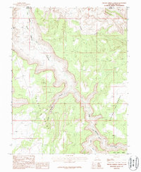
1987 Map of Trough Springs Canyon
USGS Topo · Published 1987About this map
Trough Springs Canyon dominates this 1980s landscape at the border of Grand and San Juan counties. The area is defined by massive plateau features and deep drainage systems, including the prominent elevated expanse of Hatch Point and the complex terrain of Behind the Rocks to the east. Evidence of geologic exploration and small-scale resource extraction is visible through several marked sites, including an Adit and a Prospect located near the southern canyon walls. The hydrologic network is centered on the namesake Trough Springs, which feed into the rugged topography near Hatch Wash and Kane Springs Creek. This survey captures the region just before modern recreational usage intensified, documenting natural landmarks such as a Natural Arch and the broad Flat Iron Mesa.
Find a feature on this map
14 named features on this map. Tap any name to fly to it.
Don’t see what you’re looking for? This feature index may not catch every label — zoom into the map to look around manually.
Map Details
Editions of this 1987 Trough Springs Canyon Map
This is the sole edition of this map. No revisions or reprints were ever made.
Other maps of this area

1885 · La Sal
USGS Topo · 1:250,000

1952 · Moab 4 SW
USGS Topo · 1:24,000

1954 · Mt Peale 2 SW
USGS Topo · 1:24,000

1954 · Mt Peale 2 NW
USGS Topo · 1:24,000

1954 · Carlisle 1 NE
USGS Topo · 1:24,000

1954 · Carlisle 1 SE
USGS Topo · 1:24,000

1954 · Carlisle 1 NW
USGS Topo · 1:24,000

1954 · Mt. Waas 3 SW
USGS Topo · 1:24,000

1954 · Carlisle 1 SW
USGS Topo · 1:24,000

1954 · La Sal Junction
USGS Topo · 1:62,500