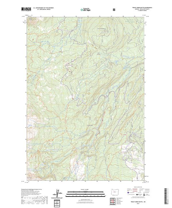
2023 Map of Trout Creek Butte
USGS Topo · Published 2023About this map
Whychus Creek Wild and Scenic River dominates the hydrology of this high-elevation landscape within the Deschutes National Forest. The topography is defined by the volcanic features of the Cascade Range, including Millican Crater and the prominent Trout Creek Butte. A complex network of water flows through the area, with the North Fork Whychus Creek and South Fork Whychus Creek converging near spectacular landmarks like Chush Falls and Upper Chush Falls.
Find a feature on this map
51 named features on this map. Tap any name to fly to it.
Don’t see what you’re looking for? This feature index may not catch every label — zoom into the map to look around manually.
Map Details
Editions of this 2023 Trout Creek Butte Map
This is the sole edition of this map. No revisions or reprints were ever made.
Other maps of this area

1929 · Three Sisters
USGS Topo · 1:125,000

1932 · Three Sisters
USGS Topo · 1:125,000

1955 · Bend
USGS Topo · 1:250,000

1957 · Bend
USGS Topo · 1:250,000

1958 · Bend
USGS Topo · 1:250,000

1959 · Broken Top
USGS Topo · 1:62,500
1959 · Three Sisters
USGS Topo · 1:62,500

1959 · Three Fingered Jack
USGS Topo · 1:62,500

1959 · Sisters
USGS Topo · 1:62,500
1980 · Bend
USGS Topo · 1:100,000