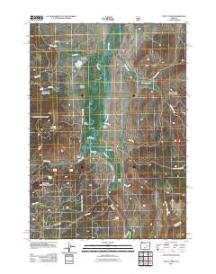
2011 Map of Trout Creek
USGS Topo · Published 2011About this map
Silvies Valley serves as the central geographic focus of this eastern Oregon landscape, where the meandering Silvies River and its numerous tributaries create a hub for cattle ranching. The map documents several established landholdings, including Silvies Valley Ranch, Craddock Ranch, and Purdy Ranch, which are situated along the valley floor. Water management is evident through features like the West Side Ditch and the presence of numerous named water sources such as Buffalo Lake, Ranger Spring, and Curry Spring. To the north and west, the terrain transitions into more defined formations like Badger Canyon and Loco Canyon. The eastern portion of the quadrangle is dominated by the headwaters of Trout Creek and its branches, including North Fork Trout Creek and Middle Fork Trout Creek.
Find a feature on this map
31 named features on this map. Tap any name to fly to it.
Don’t see what you’re looking for? This feature index may not catch every label — zoom into the map to look around manually.
Map Details
Editions of this 2011 Trout Creek Map
This is the sole edition of this map. No revisions or reprints were ever made.
Other maps of this area

1955 · Burns
USGS Topo · 1:250,000

1955 · Canyon City
USGS Topo · 1:250,000

1958 · Burns
USGS Topo · 1:250,000

1959 · Burns
USGS Topo · 1:250,000

1959 · Canyon City
USGS Topo · 1:250,000

1959 · West Myrtle Butte
USGS Topo · 1:62,500

1961 · Calamity Butte
USGS Topo · 1:62,500

1961 · Logdell
USGS Topo · 1:62,500

1961 · Seneca
USGS Topo · 1:62,500

1978 · John Day
USGS Topo · 1:100,000