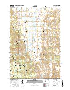
2017 Map of Trout Creek
USGS Topo · Published 2017About this map
Malheur National Forest dominates the southern reaches of this high-altitude landscape, where the terrain transitions into the wide, marshy expanse of Silvies Valley. The Silvies River meanders through the central basin, fed by a complex network of seasonal drainages and named springs like Smith Spring and Curry Spring. This area is defined by its water management and forestry infrastructure, visible in the W Side Ditch and numerous forest development roads that penetrate the drainages of Badger Canyon and Loco Canyon. The intersection of Grant and Harney counties divides the sheet, marking a remote boundary in the Oregon backcountry. Researchers can trace the path of the Silvies River as it passes near Buffalo Lake, illustrating the hydrological patterns of the northern Great Basin's edge.
Find a feature on this map
48 named features on this map. Tap any name to fly to it.
Don’t see what you’re looking for? This feature index may not catch every label — zoom into the map to look around manually.
Map Details
Editions of this 2017 Trout Creek Map
This is the sole edition of this map. No revisions or reprints were ever made.
Other maps of this area

1955 · Burns
USGS Topo · 1:250,000

1955 · Canyon City
USGS Topo · 1:250,000

1958 · Burns
USGS Topo · 1:250,000

1959 · Burns
USGS Topo · 1:250,000

1959 · Canyon City
USGS Topo · 1:250,000

1959 · West Myrtle Butte
USGS Topo · 1:62,500

1961 · Calamity Butte
USGS Topo · 1:62,500

1961 · Logdell
USGS Topo · 1:62,500

1961 · Seneca
USGS Topo · 1:62,500

1978 · John Day
USGS Topo · 1:100,000