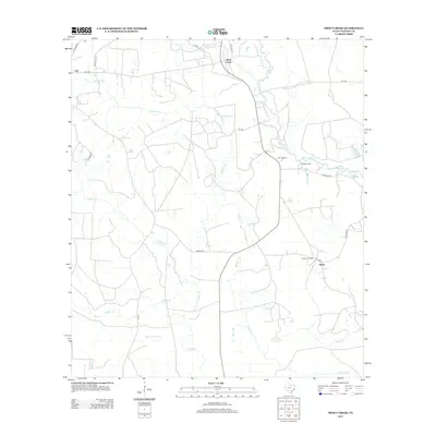
2012 Map of Trout Creek
USGS Topo · Published 2012About this map
Big Cow Creek and Trout Creek define the drainage of this East Texas landscape, where the piney woods of Newton County meet industrial and recreational sites. The settlement of Call occupies the northwestern corner, while the eastern portion of the quadrangle is marked by the presence of the Newton Oil Field near Salem. This 2012 depiction captures a mix of traditional watercourse names and modern infrastructure, showing the complex network of creeks like Slaydons Creek and Nichols Creek that crisscross the terrain.
Find a feature on this map
30 named features on this map. Tap any name to fly to it.
Don’t see what you’re looking for? This feature index may not catch every label — zoom into the map to look around manually.
Map Details
Editions of this 2012 Trout Creek Map
This is the sole edition of this map. No revisions or reprints were ever made.
Other maps of this area

1935 · Wilson Lake
USGS Topo · 1:31,680

1947 · Carter Creek
USGS Topo · 1:31,680

1947 · Wilson Lake
USGS Topo · 1:31,680

1949 · Bancroft
USGS Topo · 1:31,680

1952 · Lake Charles
USGS Topo · 1:250,000

1954 · Lake Charles
USGS Topo · 1:250,000

1955 · Bessmay
USGS Topo · 1:62,500

1958 · Kirbyville
USGS Topo · 1:62,500
1959 · Starks
USGS Topo · 1:62,500
1959 · Bon Wier
USGS Topo · 1:62,500