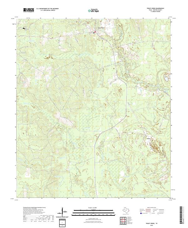
2022 Map of Trout Creek
USGS Topo · Published 2022About this map
The community of Trout Creek and its neighboring settlement of Salem anchor this portion of Newton County, characterized by a complex network of wetlands and seasonal drainages. Local genealogists will find significant value in the distribution of burial sites, including the Call Cem, Call Community Cem, and the Trout Creek Cem located near the northern crossroads. The landscape is defined by the heavy presence of low-lying water features such as Gum Slough and Reese Marsh, which transition into defined channels like Big Cow Creek and Slaydons Cr. This 2022 survey illustrates the modern road network, including the intersection of FM 1004 and FM 82, while tracing the meandering path of The Cutoff and Little Cypress Cr through the southern timberlands.
Find a feature on this map
53 named features on this map. Tap any name to fly to it.
Don’t see what you’re looking for? This feature index may not catch every label — zoom into the map to look around manually.
Map Details
Editions of this 2022 Trout Creek Map
This is the sole edition of this map. No revisions or reprints were ever made.
Other maps of this area

1935 · Wilson Lake
USGS Topo · 1:31,680

1947 · Carter Creek
USGS Topo · 1:31,680

1947 · Wilson Lake
USGS Topo · 1:31,680

1949 · Bancroft
USGS Topo · 1:31,680

1952 · Lake Charles
USGS Topo · 1:250,000

1954 · Lake Charles
USGS Topo · 1:250,000

1955 · Bessmay
USGS Topo · 1:62,500

1958 · Kirbyville
USGS Topo · 1:62,500
1959 · Starks
USGS Topo · 1:62,500
1959 · Bon Wier
USGS Topo · 1:62,500