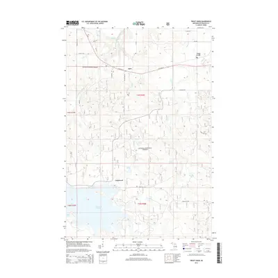
2014 Map of Trout Creek
USGS Topo · Published 2014About this map
The Middle Branch Ontonagon River defines the landscape of this portion of the Ottawa National Forest, characterized by its numerous drops and water features. Prominent landmarks such as Agate Falls and Little Falls punctuate the river's course, while the southern reaches of the map are dominated by the large Bond Falls Flowage. This area reflects the rural settlement patterns of Michigan's Upper Peninsula, with small communities like Trout Creek, Agate, and Calderwood situated along transport corridors like State Hwy 28 and Calderwood Rd. For genealogists, the Agate Cem provides a specific point of local historical interest. The terrain is further mapped with numerous interior lakes, including Mattie Lake, Johnson Lake, and Moll Lake, which are interconnected by a network of creeks such as Trout Cr and Payne Cr.
Find a feature on this map
41 named features on this map. Tap any name to fly to it.
Don’t see what you’re looking for? This feature index may not catch every label — zoom into the map to look around manually.
Map Details
Editions of this 2014 Trout Creek Map
This is the sole edition of this map. No revisions or reprints were ever made.
Other maps of this area

1949 · Rockland
USGS Topo · 1:62,500

1951 · Rockland
USGS Topo · 1:62,500

1952 · Watersmeet
USGS Topo · 1:62,500

1954 · Rousseau
USGS Topo · 1:62,500

1954 · Kenton
USGS Topo · 1:62,500

1958 · Iron River
USGS Topo · 1:250,000

1960 · Iron River
USGS Topo · 1:250,000

1961 · Iron River
USGS Topo · 1:250,000

1967 · Iron River
USGS Topo · 1:250,000

1979 · Ontonagon
USGS Topo · 1:100,000