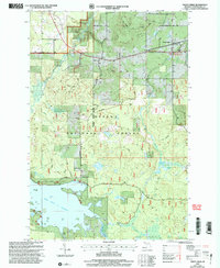
1999 Map of Trout Creek
USGS Topo · Published 2004About this map
The Middle Branch Ontonagon River dominates this landscape within the Ottawa National Forest, where hydropower and conservation converge. The expansive Bond Falls Flowage in the south provides a massive reservoir upstream from the notable Bond Falls. This area of Ontonagon County is defined by its water resources, with numerous named lakes like Mollie Lake and Johnson Lake dotting the forest floor. Small settlements including Agate, Trout Creek, and Calderwood are connected by a network of timber and access roads such as Calderwood Road. Genealogists and local historians will find the Agate Cem and the Gospel Mission Ch near Calderwood as essential landmarks of the community's social fabric. The presence of several Gravel Pits and a Gaging Station reflects the region's managed natural resources and industrial infrastructure during the late twentieth century.
Find a feature on this map
30 named features on this map. Tap any name to fly to it.
Don’t see what you’re looking for? This feature index may not catch every label — zoom into the map to look around manually.
Map Details
Editions of this 1999 Trout Creek Map
This is the sole edition of this map. No revisions or reprints were ever made.
Other maps of this area

1949 · Rockland
USGS Topo · 1:62,500

1951 · Rockland
USGS Topo · 1:62,500

1952 · Watersmeet
USGS Topo · 1:62,500

1954 · Rousseau
USGS Topo · 1:62,500

1954 · Kenton
USGS Topo · 1:62,500

1958 · Iron River
USGS Topo · 1:250,000

1960 · Iron River
USGS Topo · 1:250,000

1961 · Iron River
USGS Topo · 1:250,000

1967 · Iron River
USGS Topo · 1:250,000

1979 · Ontonagon
USGS Topo · 1:100,000