
1921 Map of Trout Run
USGS Topo · Published 1957About this map
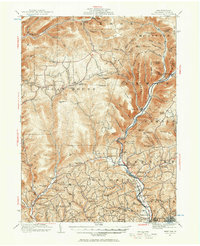
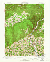
Lycoming Creek and the Pennsylvania railroad corridor define the geography of this 1920s survey, where industrial legacy and mountain settlement intersect. Evidence of early manufacturing is found at Nail Factory Mtn and the nearby Falls Factory School, while the valley floor is dotted with small agricultural and milling centers like Balls Mills and Hepburnville. The rugged highlands are organized around family-named peaks and ridges such as Cochran Mtn and Hanlon Mtn, interspersed with a high density of one-room schoolhouses like Steam Mill School and Limber Bridge School. Near the southern edge, the growth of Williamsport begins to touch the rural landscape at Garden View and the expansive Wildwood Cemetery, marking the transition from the wilder reaches of Laurel Mtn to the urban center of the county seat.
Find a feature on this map
118 named features on this map. Tap any name to fly to it.
Don’t see what you’re looking for? This feature index may not catch every label — zoom into the map to look around manually.
Map Details
Editions of this 1921 Trout Run Map
Other maps of this area

1921 · Williamsport
USGS Topo · 1:48,000

1921 · Lock Haven
USGS Topo · 1:62,500

1923 · Lock Haven
USGS Topo · 1:62,500

1923 · Trout Run
USGS Topo · 1:62,500

1923 · Williamsport
USGS Topo · 1:62,500

1924 · Milton
USGS Topo · 1:62,500

1925 · Blossburg
USGS Topo · 1:62,500

1927 · Blossburg
USGS Topo · 1:62,500

1930 · Warrensville
USGS Topo · 1:62,500

1934 · Warrensville
USGS Topo · 1:62,500
Featured Places
- Williamsport, PA
- Garden View, Old Lycoming Township
- Salladasburg, PA
- Woodward Township, PA
- Steam Valley, Cogan House Township