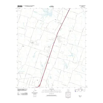
2010 Map of Troy
USGS Topo · Published 2010About this map
Troy and Pendleton anchor this Bell County landscape, where the agricultural traditions of Central Texas meet modern infrastructure. The area is defined by a series of north-south running creeks, including Big Elm Creek and Little Elm Creek, which have shaped the settlement patterns of these communities for generations. A significant concentration of rural burial grounds, such as Old Troy Cemetery and Mount Zion Cemetery, offers vital coordinates for genealogists tracing the early families of the region.
Find a feature on this map
71 named features on this map. Tap any name to fly to it.
Don’t see what you’re looking for? This feature index may not catch every label — zoom into the map to look around manually.
Map Details
Editions of this 2010 Troy Map
This is the sole edition of this map. No revisions or reprints were ever made.
Other maps of this area

1892 · Temple
USGS Topo · 1:125,000

1924 · Temple 2-C
USGS Topo · 1:48,000

1924 · Temple 3-C
USGS Topo · 1:48,000

1924 · Temple 3-B
USGS Topo · 1:48,000

1931 · Mc Gregor
USGS Topo · 1:62,500

1931 · Belton
USGS Topo · 1:62,500

1954 · Waco
USGS Topo · 1:250,000

1955 · Waco
USGS Topo · 1:250,000

1957 · Bruceville
USGS Topo · 1:24,000
1963 · Seaton
USGS Topo · 1:24,000