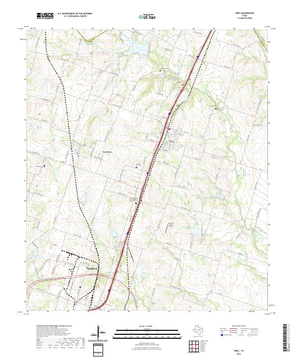
2022 Map of Troy
USGS Topo · Published 2022About this map
The agricultural corridor of North Central Texas is defined here by the Interstate 35 axis, connecting the northern outskirts of Temple with the communities of Pendleton and Troy. This modern landscape retains the markers of its rural heritage through a series of family and community burial grounds, such as Old Troy Cem and Shiloh Cem, which dot the rolling divides between local drainages. The area is heavily dissected by a network of waterways including Big Elm Creek and Cottonwood Cr, illustrating the relationship between the prairie terrain and the development of local farm-to-market roads like FM 1237. Land use patterns show a mix of established residential growth near the interstate and larger ranching operations, evidenced by the Buckshot Ranch Airport situated east of the primary transit corridor. This survey provides a clear view of the contemporary intersection between expanding urban footprints and the traditional landscape of Bell County.
Find a feature on this map
109 named features on this map. Tap any name to fly to it.
Don’t see what you’re looking for? This feature index may not catch every label — zoom into the map to look around manually.
Map Details
Editions of this 2022 Troy Map
This is the sole edition of this map. No revisions or reprints were ever made.
Other maps of this area

1892 · Temple
USGS Topo · 1:125,000

1924 · Temple 2-C
USGS Topo · 1:48,000

1924 · Temple 3-C
USGS Topo · 1:48,000

1924 · Temple 3-B
USGS Topo · 1:48,000

1931 · Mc Gregor
USGS Topo · 1:62,500

1931 · Belton
USGS Topo · 1:62,500

1954 · Waco
USGS Topo · 1:250,000

1955 · Waco
USGS Topo · 1:250,000

1957 · Bruceville
USGS Topo · 1:24,000
1963 · Seaton
USGS Topo · 1:24,000