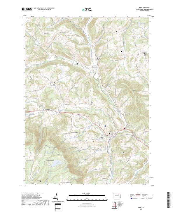
2023 Map of Troy
USGS Topo · Published 2023About this map
Troy serves as a central hub in this Bradford County landscape, where the North Branch Sugar Creek and Sugar Creek converge. The area's settlement pattern is defined by small clusters such as Columbia Cross Roads, Sylvania, and Austinville, many of which are linked by winding routes like Austinville Rd and Berrytown Rd. For those researching family lineages, the map is densely packed with burial sites, including the Chase - Newbury Cem, Saint Johns Cem, and Columbia Valley Cem, many of which sit near historical property boundaries and small waterways.
Find a feature on this map
91 named features on this map. Tap any name to fly to it.
Don’t see what you’re looking for? This feature index may not catch every label — zoom into the map to look around manually.
Map Details
Editions of this 2023 Troy Map
This is the sole edition of this map. No revisions or reprints were ever made.
Other maps of this area

1931 · Troy
USGS Topo · 1:48,000

1938 · Troy
USGS Topo · 1:62,500

1939 · Sayre
USGS Topo · 1:62,500

1942 · Sayre
USGS Topo · 1:62,500

1942 · Canton
USGS Topo · 1:62,500

1943 · Powell
USGS Topo · 1:62,500

1944 · Canton
USGS Topo · 1:62,500

1945 · Powell
USGS Topo · 1:62,500

1948 · Sayre
USGS Topo · 1:62,500

1953 · Roseville
USGS Topo · 1:24,000