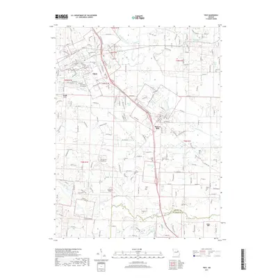
2017 Map of Troy
USGS Topo · Published 2017About this map
The Troy landscape in Lincoln County is defined by the winding course of the Cuivre River and its numerous tributaries, including Whitcomb Br and Sugar Cr. This area serves as a primary hub of residential and light industrial growth, with significant development concentrated around Moscow Mills and the southern outskirts of the county seat. The topography reveals a mix of creek-fed lowlands and more prominent elevations like Frenchman Bluff to the north.
Find a feature on this map
196 named features on this map. Tap any name to fly to it.
Don’t see what you’re looking for? This feature index may not catch every label — zoom into the map to look around manually.
Map Details
Editions of this 2017 Troy Map
This is the sole edition of this map. No revisions or reprints were ever made.
Other maps of this area

1890 · Louisiana
USGS Topo · 1:125,000

1890 · Hermann
USGS Topo · 1:125,000

1903 · O'Fallon
USGS Topo · 1:125,000

1934 · Elsberry
USGS Topo · 1:48,000

1937 · Silex
USGS Topo · 1:62,500

1939 · Silex
USGS Topo · 1:48,000

1941 · Troy
USGS Topo · 1:62,500

1942 · Elsberry
USGS Topo · 1:62,500

1943 · Warrenton
USGS Topo · 1:62,500

1945 · Troy
USGS Topo · 1:62,500