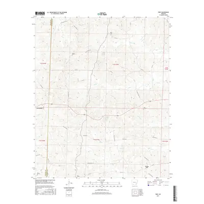
2017 Map of Troy
USGS Topo · Published 2017About this map
Troy and Mendenhall anchor this rural landscape along the border of Nevada and Ouachita counties, where a complex network of waterways defines the local geography. The terrain is intricately carved by several significant drainages, including Lewis Bayou, Cypress Cr, and Hale Cr, which feed into the larger river systems of the region. This survey captures a pocket of South Arkansas where community life is centered around family and faith, evidenced by numerous longstanding landmarks such as Adams Chapel Cem and the Hickory Ridge Cem north of the main settlements.
Find a feature on this map
48 named features on this map. Tap any name to fly to it.
Don’t see what you’re looking for? This feature index may not catch every label — zoom into the map to look around manually.
Map Details
Editions of this 2017 Troy Map
This is the sole edition of this map. No revisions or reprints were ever made.
Other maps of this area

1901 · Gurdon
USGS Topo · 1:125,000

1903 · Camden
USGS Topo · 1:125,000

1953 · El Dorado
USGS Topo · 1:250,000

1957 · El Dorado
USGS Topo · 1:250,000

1958 · El Dorado
USGS Topo · 1:250,000

1960 · El Dorado
USGS Topo · 1:250,000

1962 · Buena Vista
USGS Topo · 1:24,000

1964 · Louann
USGS Topo · 1:62,500
1969 · Stephens
USGS Topo · 1:24,000
1969 · Magnolia NW
USGS Topo · 1:24,000