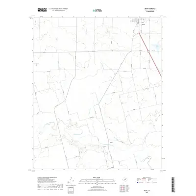
2019 Map of Truby
USGS Topo · Published 2019About this map
Clear-Fork Brazos River meanders through this portion of Jones County, carving a distinct path through the West Texas landscape. The settlement of Truby is located south of the river, marked by the presence of Truby Cem, a key landmark for local genealogists. To the north, the southern edge of Anson begins to take shape, where the intersection of highways 83 277 and several county roads facilitate movement across the plains.
Find a feature on this map
59 named features on this map. Tap any name to fly to it.
Don’t see what you’re looking for? This feature index may not catch every label — zoom into the map to look around manually.
Map Details
Editions of this 2019 Truby Map
This is the sole edition of this map. No revisions or reprints were ever made.
Other maps of this area

1891 · Anson
USGS Topo · 1:125,000

1893 · Roby
USGS Topo · 1:125,000

1893 · Anson
USGS Topo · 1:125,000

1954 · Big Spring
USGS Topo · 1:250,000

1954 · Abilene
USGS Topo · 1:250,000

1957 · Hawley
USGS Topo · 1:62,500
1957 · Hawley
USGS Topo · 1:24,000

1957 · Noodle
USGS Topo · 1:62,500

1958 · Big Spring
USGS Topo · 1:250,000

1958 · Abilene
USGS Topo · 1:250,000