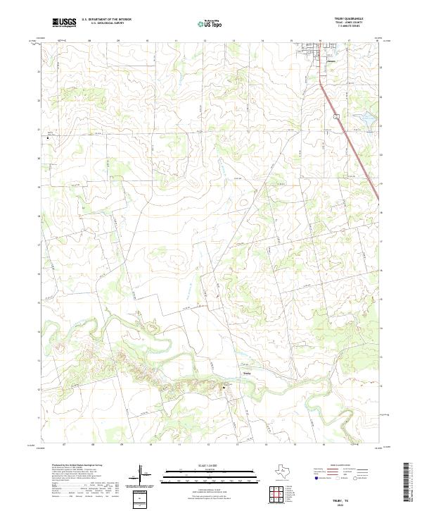
2022 Map of Truby
USGS Topo · Published 2022About this map
The Clear Fork Brazos River winds through the southern portion of this Jones County landscape, defining the local topography near the small community of Truby. The settlement pattern here is characteristic of the Texas rolling plains, where farm-to-market roads like FM 707 and FM 3116 connect isolated homesteads and agricultural tracts. Genealogy researchers will find significant value in the documentation of the Truby Cem and the Prairie View Cem located to the west. To the north, the southern outskirts of Anson are visible, showing the transition from a structured street grid—including Commercial Ave and numbered streets like 20th St—into the surrounding ranchland. Water features such as Anson South Lake, Dark Hollow Br, and Redmud Cr indicate the drainage patterns that have historically dictated land use in this semi-arid region.
Find a feature on this map
60 named features on this map. Tap any name to fly to it.
Don’t see what you’re looking for? This feature index may not catch every label — zoom into the map to look around manually.
Map Details
Editions of this 2022 Truby Map
This is the sole edition of this map. No revisions or reprints were ever made.
Other maps of this area

1891 · Anson
USGS Topo · 1:125,000

1893 · Roby
USGS Topo · 1:125,000

1893 · Anson
USGS Topo · 1:125,000

1954 · Big Spring
USGS Topo · 1:250,000

1954 · Abilene
USGS Topo · 1:250,000

1957 · Hawley
USGS Topo · 1:62,500
1957 · Hawley
USGS Topo · 1:24,000

1957 · Noodle
USGS Topo · 1:62,500

1958 · Big Spring
USGS Topo · 1:250,000

1958 · Abilene
USGS Topo · 1:250,000