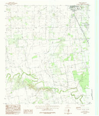
1984 Map of Truby
USGS Topo · Published 1984About this map
The Clear Fork Brazos River snakes through the southern reaches of this West Texas landscape, defining a winding riparian corridor across Jones County. To the north, the town of Anson serves as a local hub, situated near the headwaters of Carter Creek and the man-made Anson South Lake. The topography is characterized by drainage systems like Redmud Creek and Dark Hollow Branch, which converge toward the river valley. Sparse settlement patterns are punctuated by the small community of Truby and various industrial features including several Gravel Pits and a prominent Radio Tower. Cultural landmarks such as a local Cem and the elevation of Bull Hill provide specific points of interest for those tracing the development of this ranching and agricultural region during the late 1970s and early 1980s.
Find a feature on this map
12 named features on this map. Tap any name to fly to it.
Don’t see what you’re looking for? This feature index may not catch every label — zoom into the map to look around manually.
Map Details
Editions of this 1984 Truby Map
This is the sole edition of this map. No revisions or reprints were ever made.
Other maps of this area

1891 · Anson
USGS Topo · 1:125,000

1893 · Roby
USGS Topo · 1:125,000

1893 · Anson
USGS Topo · 1:125,000

1954 · Big Spring
USGS Topo · 1:250,000

1954 · Abilene
USGS Topo · 1:250,000

1957 · Hawley
USGS Topo · 1:62,500
1957 · Hawley
USGS Topo · 1:24,000

1957 · Noodle
USGS Topo · 1:62,500

1958 · Big Spring
USGS Topo · 1:250,000

1958 · Abilene
USGS Topo · 1:250,000