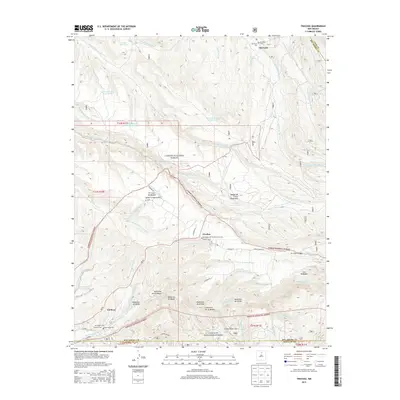
2013 Map of Truchas
USGS Topo · Published 2013About this map
The high-altitude village of Truchas sits at the heart of this landscape, surrounded by a complex system of water management and traditional settlements. This area of Northern New Mexico is defined by its dramatic relief, spanning the Sangre de Cristo Mountains and the Santa Fe Mountains. The map traces the historical agricultural lifeblood of the region through features like the Acequia de Ojo Sarco and numerous seasonal drainages including Cañada de la Entrañas and Cañada Honda.
Find a feature on this map
66 named features on this map. Tap any name to fly to it.
Don’t see what you’re looking for? This feature index may not catch every label — zoom into the map to look around manually.
Map Details
Editions of this 2013 Truchas Map
This is the sole edition of this map. No revisions or reprints were ever made.
Other maps of this area

1889 · Santa Fe
USGS Topo · 1:125,000

1894 · Santa Fe
USGS Topo · 1:125,000

1953 · Truchas
USGS Topo · 1:24,000

1953 · Velarde
USGS Topo · 1:24,000

1953 · Sierra Mosca
USGS Topo · 1:24,000
1953 · Cundiyo
USGS Topo · 1:24,000

1953 · Trampas
USGS Topo · 1:24,000

1953 · Chimayo
USGS Topo · 1:24,000

1954 · Santa Fe
USGS Topo · 1:250,000

1954 · Raton
USGS Topo · 1:250,000