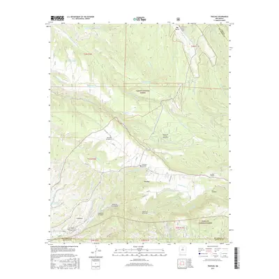
2017 Map of Truchas
USGS Topo · Published 2017About this map
The high-altitude village of Truchas anchors this landscape, situated between the Carson National Forest and the Santa Fe National Forest. The settlement pattern reflects the traditional land uses of the Santa Fe Mountains, with agricultural life clustered near water sources like the Rio de Truchas and the Rio Quemado. This 2017 survey details the complex network of mountain drainages, including Cañada de los Tanos and Cañada Honda, which dictate the placement of roads and homesteads.
Find a feature on this map
69 named features on this map. Tap any name to fly to it.
Don’t see what you’re looking for? This feature index may not catch every label — zoom into the map to look around manually.
Map Details
Editions of this 2017 Truchas Map
This is the sole edition of this map. No revisions or reprints were ever made.
Other maps of this area

1889 · Santa Fe
USGS Topo · 1:125,000

1894 · Santa Fe
USGS Topo · 1:125,000

1953 · Truchas
USGS Topo · 1:24,000

1953 · Velarde
USGS Topo · 1:24,000

1953 · Sierra Mosca
USGS Topo · 1:24,000
1953 · Cundiyo
USGS Topo · 1:24,000

1953 · Trampas
USGS Topo · 1:24,000

1953 · Chimayo
USGS Topo · 1:24,000

1954 · Santa Fe
USGS Topo · 1:250,000

1954 · Raton
USGS Topo · 1:250,000