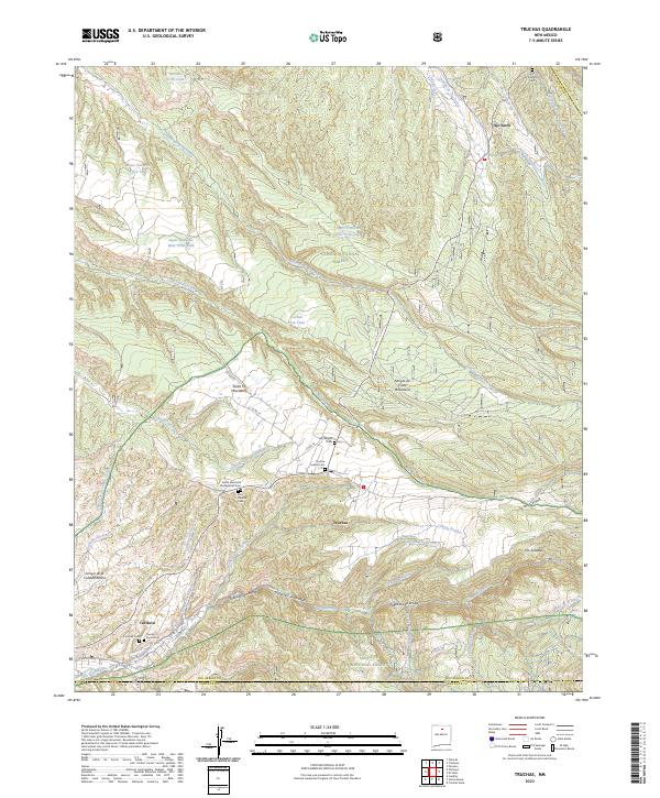
2023 Map of Truchas
USGS Topo · Published 2023About this map
Truchas and Ojo Sarco anchor this high-altitude landscape where the Santa Fe Mountains meet the Sangre de Cristo Mountains. The settlement patterns here are deeply rooted in communal land management and traditional irrigation, evidenced by the presence of the Acequia de Ojo Sarco and various trick tanks like Jacinto Trick Tank. This 2023 survey documents the enduring presence of local religious and community heritage through numerous burial grounds, including the Truchas Pueblo Cem, San Miguel Cem, and Smith Memorial Presbyterian Cem. The terrain is defined by a dense network of mountain drainages such as Rio de Truchas and Rio Quemado, which carve through the Vallecitos de Abajo and Vallecitos de Arriba. Between the Carson National Forest and Santa Fe National Forest, the map reveals a rugged interface of public lands and traditional New Mexican villages.
Find a feature on this map
51 named features on this map. Tap any name to fly to it.
Don’t see what you’re looking for? This feature index may not catch every label — zoom into the map to look around manually.
Map Details
Editions of this 2023 Truchas Map
This is the sole edition of this map. No revisions or reprints were ever made.
Other maps of this area

1889 · Santa Fe
USGS Topo · 1:125,000

1894 · Santa Fe
USGS Topo · 1:125,000

1953 · Truchas
USGS Topo · 1:24,000

1953 · Velarde
USGS Topo · 1:24,000

1953 · Sierra Mosca
USGS Topo · 1:24,000
1953 · Cundiyo
USGS Topo · 1:24,000

1953 · Trampas
USGS Topo · 1:24,000

1953 · Chimayo
USGS Topo · 1:24,000

1954 · Santa Fe
USGS Topo · 1:250,000

1954 · Raton
USGS Topo · 1:250,000