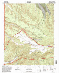
1995 Map of Truchas
USGS Topo · Published 1997About this map
Truchas and its surrounding mountain settlements represent a complex network of historic land grants and high-altitude water management in Northern New Mexico. The landscape is defined by the Sangre de Cristo Mountains and partitioned by numerous land grants, including the Sebastian Martin Grant, Las Trampas Grant, and the expansive La Merced de Nuestra Senora del Rosario San Fernando y Santiago Grant. Evidence of the region's agricultural heritage is found in the many irrigation features like the Rio de Truchas and several ditch systems. This 1995 revision reveals a mix of traditional communities such as Ojo Sarco and Cordova alongside specialized infrastructure like the Jacinto Trick Tank and Upper Entranas Trick Tank #2, which support land use within the Carson National Forest and Santa Fe National Forest.
Find a feature on this map
52 named features on this map. Tap any name to fly to it.
Don’t see what you’re looking for? This feature index may not catch every label — zoom into the map to look around manually.
Map Details
Editions of this 1995 Truchas Map
This is the sole edition of this map. No revisions or reprints were ever made.
Other maps of this area

1889 · Santa Fe
USGS Topo · 1:125,000

1894 · Santa Fe
USGS Topo · 1:125,000

1953 · Truchas
USGS Topo · 1:24,000

1953 · Velarde
USGS Topo · 1:24,000

1953 · Sierra Mosca
USGS Topo · 1:24,000
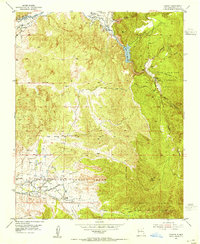
1953 · Cundiyo
USGS Topo · 1:24,000

1953 · Trampas
USGS Topo · 1:24,000

1953 · Chimayo
USGS Topo · 1:24,000

1954 · Santa Fe
USGS Topo · 1:250,000

1954 · Raton
USGS Topo · 1:250,000