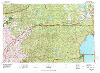
1977 Map of Truckee
USGS Topo · Published 1978About this map
Lake Tahoe and the high Sierra peaks define this 1977 landscape, where the Southern Pacific railroad and Interstate 80 trace the historic transit corridor through Truckee. The map captures the region's complex water management and recreational evolution, featuring major impoundments like Stampede Reservoir, French Meadows Reservoir, and Hell Hole Reservoir. Settlements range from the established shoreline communities of Tahoe City and Kings Beach to the winter sports hub at Olympic Valley.
Find a feature on this map
74 named features on this map. Tap any name to fly to it.
Don’t see what you’re looking for? This feature index may not catch every label — zoom into the map to look around manually.
Map Details
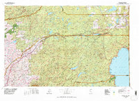
Editions of this 1977 Truckee Map
2 editions found
Other maps of this area

1888 · Smartsville
USGS Topo · 1:125,000

1888 · Bidwell Bar
USGS Topo · 1:125,000

1889 · Pyramid Peak
USGS Topo · 1:125,000

1889 · Markleeville
USGS Topo · 1:125,000

1890 · Sierraville
USGS Topo · 1:125,000

1891 · Bidwell Bar
USGS Topo · 1:125,000

1891 · Downieville
USGS Topo · 1:125,000

1891 · Sacramento
USGS Topo · 1:125,000

1891 · Carson
USGS Topo · 1:125,000

1891 · Markleeville
USGS Topo · 1:125,000