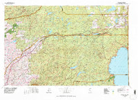
1977 Map of Truckee
USGS Topo · Published 1978About this map
The Southern Pacific railroad corridor serves as the industrial spine for this High Sierra region, threading through the mountains past high-altitude stops like Norden, Soda Springs, and Truckee. During this era of the late 1970s, the landscape reflects a complex transition from historic hydraulic mining areas near North Bloomfield and San Juan Ridge to the growing recreational centers along the northern and western shores of Lake Tahoe. Reservoirs such as Stampede Reservoir and Boca Reservoir dominate the eastern drainage, while the French Meadows Reservoir sits deep within the Tahoe National Forest to the south. The map documents the intricate network of ridges including the Forest Hill Divide and Chalk Bluff Ridge, separating the deep canyons of the South Yuba River and the Bear River. From the lower elevations at Colfax to the peaks surrounding Squaw Valley, the sheet captures the region's shift toward a permanent alpine residential and tourism economy.
Find a feature on this map
94 named features on this map. Tap any name to fly to it.
Don’t see what you’re looking for? This feature index may not catch every label — zoom into the map to look around manually.
Map Details
Editions of this 1977 Truckee Map
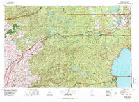
2 editions found
Other maps of this area

1888 · Smartsville
USGS Topo · 1:125,000

1888 · Bidwell Bar
USGS Topo · 1:125,000

1889 · Pyramid Peak
USGS Topo · 1:125,000

1889 · Markleeville
USGS Topo · 1:125,000

1890 · Sierraville
USGS Topo · 1:125,000

1891 · Bidwell Bar
USGS Topo · 1:125,000

1891 · Downieville
USGS Topo · 1:125,000

1891 · Sacramento
USGS Topo · 1:125,000

1891 · Carson
USGS Topo · 1:125,000

1891 · Markleeville
USGS Topo · 1:125,000